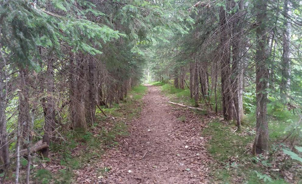
The Wagon Road is one section of "Trans-Alaska Military Trail" that was built connected Valdez to Interior Alaska during the Gold Rush. The Wagon Road offers a maintained trail through a forest of spruce and other vegetation and offers views of the Lowe River and Dutch Flats as well as Keystone Canyon. A metal foot-bridge crosses over Bear Creek along the trail.
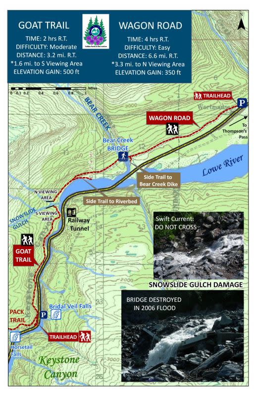
Map from Valdez Parks & Recreation. Download full trail guide.
Trail Details
Difficulty: Easy
Time: 4 hours, round trip
Distance: 6.6 miles, round trip (10.6 km)
Elevation Gain: 350 feet (107 meters)
Amenities: A trail log is available to sign near the Bear Creek Bridge
How To Get There
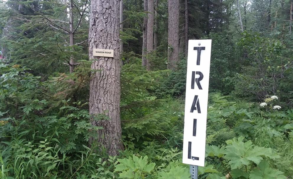
The trail-head for the Wagon Road may be reached at Mile 18 of the Richardson Highway. Look for the turnout in front of the "Welcome to Valdez" and park. The trail itself is marked by a vertical "TRAIL" sign and a smaller "Wagon Road" sign mounted to a tree.
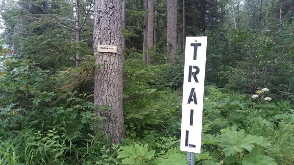
The Wagon Road Trail-Head
Safety & Etiquette
Be on alert for wildlife. Both moose and bears are known to use the trail; this is Alaska, remember to stay bear aware. There are a number of plants present along the trail in the summer to avoid, including the prickly Devil's Club, as well as wild celery, which may cause skin irritation.
The Wagon Road was connected to the Goat Trail by a bridge over Snowslide Gulch until the bridge was washed out in 2006. Attempting to cross Snowslide Gulch is now prohibited and extremely dangerous.
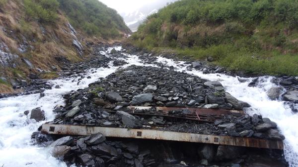
Washed out bridge along Snowslide Gulch
History
History of the Wagon Road composed by Valdez Parks & Recreation:
"Because of the increased use of the 1899 Pack Trail, it was upgraded in order to accommodate sleds, wagons, and eventually automobiles. By 1905, The Valdez Transportation Company was offering a nine-day stagecoach trip to Fairbanks for $150. In 1913, the first automobile traveled from Valdez to Fairbanks over the improved trail, even though the Goat Trail section was difficult to maintain due to snow and rock slides. The Snowslide Gulch area posed a particular problem as massive snow slides would periodically destroy or severely damage its bridge. The Bear Creek Bridge, the last of the four main trail bridges, was built in 1943 and still remains today. This 300-foot steel arch bridge is a good example of World War II construction. The Goat Trail/ Wagon Road was in use as late as 1952 when a major flood destroyed the 317-foot long Lowe River Bridge, located just upstream from the mouth of Keystone Canyon. What remains of the concrete piers can still be seen in the river. Once a through-trail, the Goat Trail and Wagon Road are now considered two separate trails because of the destruction of the bridge at Snowslide Gulch during the floods of 2006."
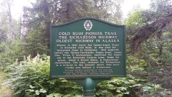
Wagon Road Historical Sign. View larger image.
Photo Gallery