Keystone Canyon Pack Trail
The original "Pack Trail" was a trail from the Port of Valdez to Eagle, Alaska built in 1898 by the US Army to provide an "All-American" route to the Klondike Goldfields. When the gold rush ended, the Army kept the trail open to connect its posts, Fort Liscum in Valdez and Fort Egbert in Eagle. By 1910, it had grown into one of the most important access routes to interior Alaska and at that time it was upgraded into a wagon road. These upgrades were overseen by US Army General Wilds P. Richardson, for whom the final "Highway" was named. Because the wagon road and eventually the Richardson Highway were chosen to follow alongside the Lowe River instead of over the mountain, this part of the pack trail was abandoned. It remained forgotten for nearly 90 years until it was relocated and cleared in 1997 and 1998. The clearing was done with hadn tools in order to retain something of the original spirit of 1899. Glimpses of the original telegraph line (installed in 1900) can still be seen along the trail. In the fall of 2006, severe floods damaged the trail and washed out several important bridges, as well as portions of the Richardson Highway through Keystone Canyon.

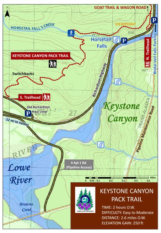
Map from Valdez Parks & Recreation. Download full trail guide.
Trail Details
Difficulty: Moderate
Estimated Time: 2 hours one way
Distance: 2.6 miles one way (4.2 km)
Elevation Gain: 250 feet (76 meters)
Amenities: Parking on the Old Richardson Highway Loop
How To Get There
The trail Take the Richardson Highway and turn on to Old Richardson Highway Loop. The trailhead is along the loop.
View more Valdez maps.
Trail Safety
Sections of the trail are over rocks which may be slippery when raining. The prickly Devil's Club plant is present on sections of the trail. And, as always, this is Alaska, so remember to be bear aware.

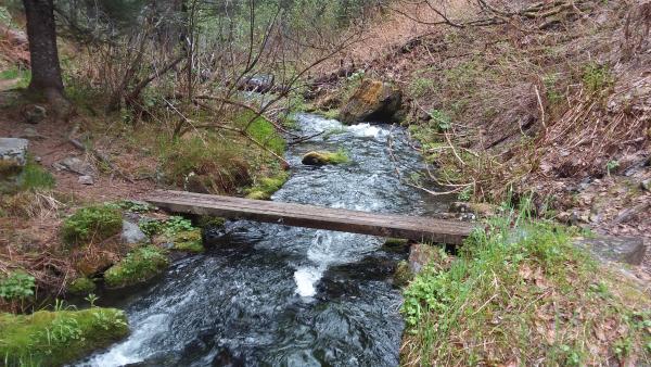
A bridge over a stream on the Pack Trail
Trail History
From Valdez Parks & Recreation: "The original 'Pack Trail' was a trail from the Port of Valdez to Eagle, Alaska built in 1898 by the US Army to provide an "All-American" route to the Klondike Goldfields. When the gold rush ended, the Army kept the trail open to connect its posts, Fort Liscum in Valdez and Fort Egbert in Eagle. By 1910, it had grown into one of the most important access routes to interior Alaska and at that time it was upgraded into a wagon road. These upgrades were overseen by US Army General Wilds P. Richardson, for whom the final "Highway" was named. Because the wagon road and eventually the Richardson Highway were chosen to follow alongside the Lowe River instead of over the mountain, this part of the pack trail was abandoned. It remained forgotten for nearly 90 years until it was relocated and cleared in 1997 and 1998. The clearing was done with hadn tools in order to retain something of the original spirit of 1899. Glimpses of the original telegraph line (installed in 1900) can still be seen along the trail. In the fall of 2006, severe floods damaged the trail and washed out several important bridges, as well as portions of the Richardson Highway through Keystone Canyon"


