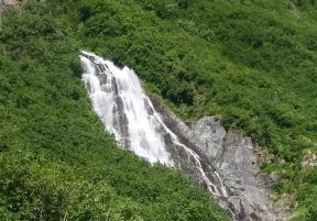
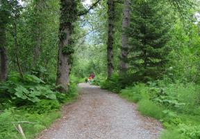
Valdez's gold mining heritage comes alive on Mineral Creek Trail. Those who hike, bike or drive through Mineral Creek Valley will see historic gold rush ruins alongside present day mining claims. The trail is a rough gravel road that begins on Mineral Creek Drive that crosses a bridge over the creek and continues for a 1.5 miles to a washout at Horsetail Creek Falls. The washout may be crossed by foot or four-wheel drive vehicle. The gravel path continues for approximately four miles, offering amazing views of glacier-fed waterfalls and wildflowers like western columbine, until reaching a gate. The trail continues past the gate as a dirt path that must be traveled by foot; the path ends at an abandoned gold rush-era stamp mill.
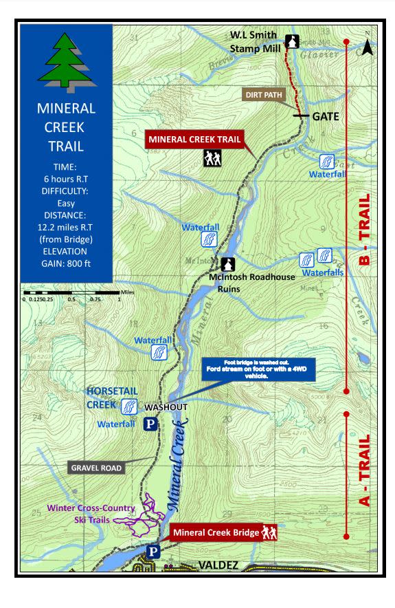
Map from City of Valdez Parks & Recreation. View full trail guide.
Trail Details
Difficulty: Moderate
Time: 6 hours round trip (by foot)
Distance: 12.2 miles round trip (19.6 km)
Elevation Gain: 800 feet (244 meters)
How To Get There
To reach the trail from downtown Valdez, head north on either Hazelet or Meals Avenue, and turn left onto Hanagita Street. Turn onto Mineral Creek Drive, and follow the road through a residential neighborhood until you reach the gravel path that marks the beginning of Mineral Creek Trail. Bike rentals and guided ATV Tours of the trail are also available in Valdez.
Another way to access the trail is to start at the intersection of Blueberry Hill Road and Egan Drive and take the "Mineral Creek Riverbed Trail" along the creek bed until reaching the same starting point.
View more Valdez maps.
Safety & Etiquette
Motorized traffic on the trail is allowed, so hikers should be aware of ATVs or other vehicles. Four-wheel drive vehicles are recommend for those traveling over the washout at Horsetail Creek. Sections of the trail are registered mining claims; please respect all posted rules and regulations.
Plants that may cause skin irritation, such as wild celery or stinging nettle, are present along some sections of the trail. As always, this is Alaska, so please remain bear aware.
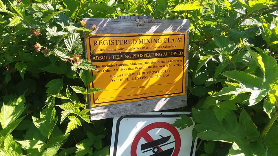
"Absolutely No Prospecting Allowed" : Please respect all posted rules.
History
Part way through the trail, about two miles past Horsetail Creek, a side-trail leads to ruins of the McIntosh Roadhouse (in operation around 1912). The very end of the trail arrives at the W.L. Smith Stamp Mill. This mill was built in 1913 by gold miners W.L. Smith and Billy Quitsch and was used in conjunction with the Mountain King Mine, which was located about 3,000 feet above sea level on the east side of Mineral Creek.